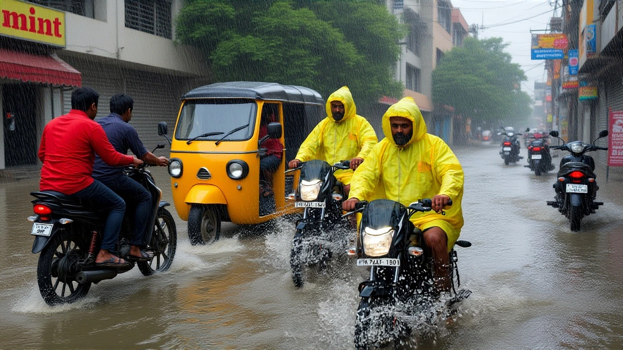
Cyclone Montha weakens to low-pressure system, now pounding Bihar and UP with heavy rains
Oct, 30 2025
After carving a path of wind and water along India’s east coast, Cyclone Montha has lost its cyclonic fury—but not its threat. The storm, named by the Kingdom of Thailand under the North Indian Ocean’s collaborative naming system, made landfall near Kakinada, Andhra Pradesh, just after midnight on October 28, 2025, with winds of 90–100 km/h and gusts hitting 110 km/h. By dawn on October 29, it had weakened into a well-marked low-pressure area, according to the India Meteorological Department (IMD) in New Delhi. But here’s the twist: its danger didn’t vanish. It moved inland, and now, Bihar and Uttar Pradesh are bracing for a deluge. The heavy rainfall expected through Wednesday and into Thursday could trigger flash floods, disrupt transport, and overwhelm drainage systems in cities like Patna, Gorakhpur, and Varanasi. This isn’t just weather—it’s a slow-motion disaster waiting to unfold.
From Coast to Interior: How a Cyclone Becomes a Rain Bomb
Cyclone Montha didn’t just appear out of nowhere. It formed over the southeast Bay of Bengal on October 27, 2025, and tracked north-northwest with eerie precision. By 2:30 p.m. IST on October 28, the IMD had it pinned at 70 km south-southeast of Machilipatnam, 150 km from Kakinada, and 480 km from Gopalpur in Odisha. Landfall happened exactly where forecasted—between Machilipatnam and Kalingapatnam—prompting swift evacuations in coastal Andhra Pradesh and Odisha. But unlike storms that fizzle out after hitting land, Montha’s moisture didn’t vanish. Instead, it got absorbed into the monsoon trough, a persistent band of low pressure that stretches from the Bay of Bengal into northern India. That’s when the real trouble began.The IMD’s 1430 hrs IST bulletin on October 28 confirmed the storm’s rapid decay. Wind speeds dropped below 50 km/h by 6 a.m. on October 29. But rainfall? That’s still climbing. The system is now moving northwest at 15–20 km/h, pushing moisture-laden air into the Gangetic plains. Historical patterns show this is typical: Cyclone Fani in 2019 weakened after hitting Odisha but dumped over 200 mm of rain in Bihar and Jharkhand days later. Montha could follow suit. No official rainfall totals have been released for Bihar yet, but The Statesman’s October 29 report bluntly warned: "likely to pound Bihar, UP with rains." That’s not speculation—it’s a red flag.
Who’s Responding—and Who’s Still Silent
In Andhra Pradesh, the political machinery kicked into gear. Yeduguri Sandinti Jagan Mohan Reddy, president of the Yuvajana Sramika Rythu Congress Party (YSRCP) and former Chief Minister, convened an emergency meeting with regional coordinators on October 29 to assess damage. Districts like East Godavari and Krishna are likely to see crop losses, damaged homes, and power outages—but no official toll has been released. Meanwhile, in Bihar and Uttar Pradesh, the response has been quieter. No state-level disaster alerts have been issued as of Wednesday evening, and local media reports are sparse. That’s worrying. These states have seen catastrophic floods in recent years: Bihar’s 2024 floods displaced over 1.2 million people. If Montha’s low-pressure system stalls over the region—something meteorologists say is possible—rainfall could exceed 150 mm in 24 hours. That’s enough to turn rivers into torrents and low-lying villages into islands.Why This Matters Beyond the Rain
This isn’t just about wet streets and delayed trains. The real risk is cascading failure. In Bihar, where 60% of the population relies on agriculture, even 48 hours of sustained rain can drown standing paddy crops. In Uttar Pradesh, urban centers like Lucknow and Kanpur have aging drainage systems—many haven’t been upgraded since the 1990s. A 2023 study by the Indian Institute of Technology Kanpur found that 78% of urban drains in the state are either clogged or undersized for monsoon-scale rainfall. Add to that the fact that millions are still recovering from last year’s floods, and you’ve got a public health emergency brewing. The IMD has warned of possible landslides in the Tarai belt of UP and Bihar’s northern districts near Nepal. Hospitals, schools, and relief centers must be ready. Yet, there’s no public announcement from state disaster management authorities. Silence is dangerous here.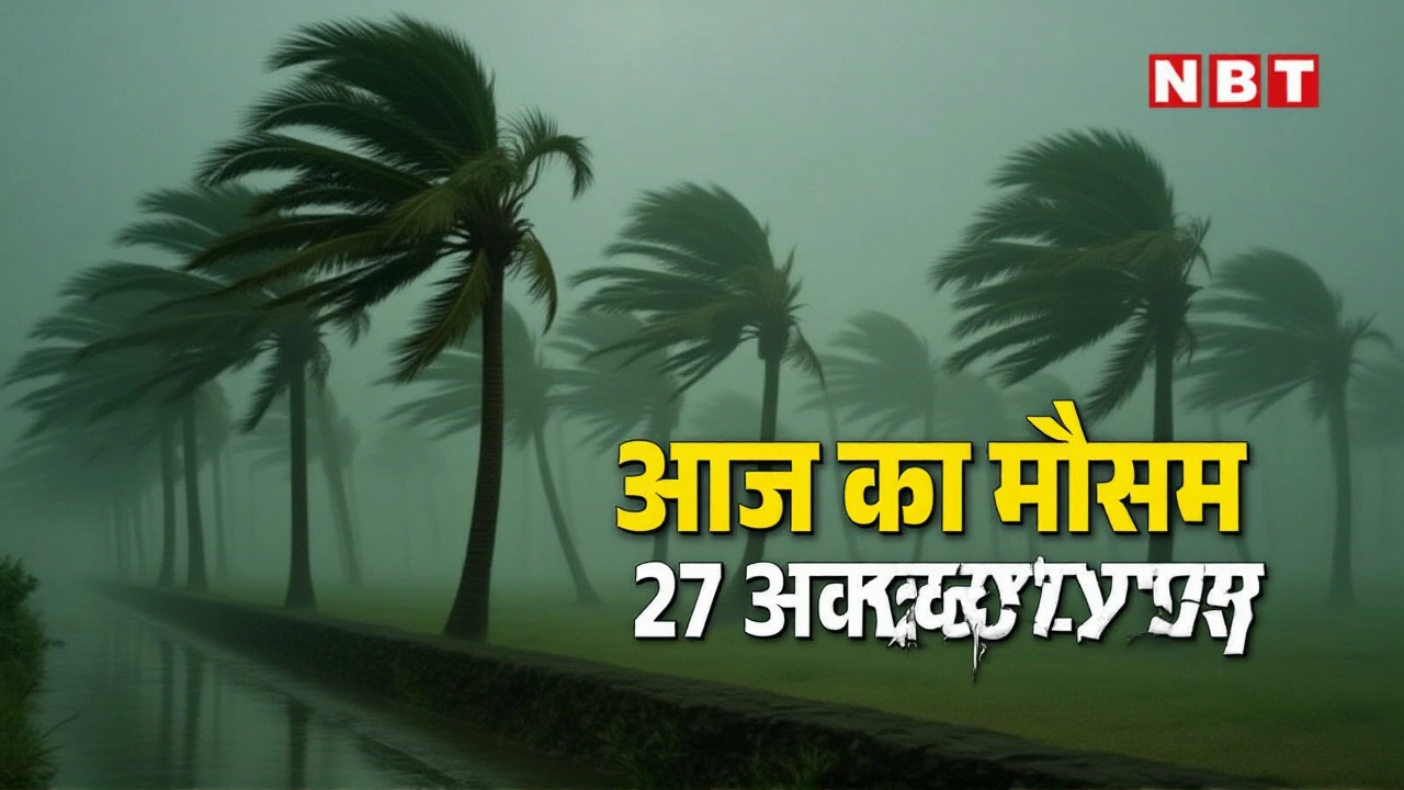
What Comes Next?
The IMD continues to monitor the system, but no further bulletins have been issued since early Wednesday. The low-pressure area is expected to weaken further by Friday, but its path remains uncertain. Will it stall over the Ganges basin? Will it merge with another system forming over the Arabian Sea? These are open questions. Historically, such systems linger longer over flat, humid terrain—and Bihar and UP are textbook examples. Residents should assume this isn’t over. The next 48 hours are critical. Keep radios tuned to IMD updates. Avoid travel near rivers. Check on elderly neighbors. Secure loose items. Don’t wait for an official alert—when the sky turns gray and the wind picks up, it’s already too late for hesitation.Behind the Name: How Cyclones Get Their Names
The name "Montha" might sound exotic, but it’s part of a carefully coordinated system. Since 2004, eight countries—India, Bangladesh, Maldives, Myanmar, Oman, Pakistan, Sri Lanka, and Thailand—have contributed names to a rotating list managed by the RSMC New Delhi. Each country submits 13 names; Thailand’s contribution includes "Montha," which means "moon" in Thai. The list cycles every few years, and names are retired only if a storm causes extreme damage or death. Montha hasn’t reached that threshold yet—but it’s close. If it triggers major flooding in Bihar or UP, the name could be retired in the next review cycle. That’s how seriously the region takes these storms.Frequently Asked Questions
How much rain is expected in Bihar and Uttar Pradesh?
While exact figures haven’t been released, the India Meteorological Department has confirmed "heavy to very heavy rainfall" is likely across most districts of Bihar and eastern Uttar Pradesh through October 30. Historical data from similar systems suggests 100–180 mm of rain in 24–48 hours, with isolated pockets receiving over 200 mm. This is enough to cause urban flooding, especially in cities with poor drainage like Patna and Gorakhpur.
Why is a weakened cyclone still dangerous?
Cyclones lose wind speed over land but retain massive amounts of moisture. When this moisture meets cooler air over the Gangetic plains, it triggers prolonged, intense rainfall—often more damaging than the original winds. Cyclone Fani in 2019 killed fewer than 100 people directly but caused over $4 billion in damage through flooding in Bihar and Jharkhand. Montha’s path mirrors that pattern.
What should residents in Bihar and UP do right now?
Stay indoors if possible, especially near rivers or low-lying areas. Keep emergency supplies ready: torch, water, medicines, and a charged power bank. Avoid driving through flooded roads—even 15 cm of water can sweep away a car. Monitor IMD bulletins via radio or official apps. Do not rely on social media rumors. Local authorities may not issue alerts quickly—assume the worst and prepare accordingly.
Has the government released any relief measures yet?
As of October 29, no official relief packages or disaster declarations have been announced by the governments of Bihar or Uttar Pradesh. In Andhra Pradesh, Chief Minister Y.S. Jagan Mohan Reddy held an internal review, but no public funding or aid figures were disclosed. This delay is concerning—response times in previous floods have been slower than needed. Residents should contact local panchayats or district disaster management offices directly for assistance.
How does Cyclone Montha compare to past storms in the region?
Montha is weaker than Cyclone Amphan (2020) or Fani (2019) in terms of wind speed, but its inland rainfall impact could be comparable. Unlike those storms, Montha didn’t hit densely populated coastal megacities. Instead, it’s targeting the agricultural heartland of North India—where infrastructure is less resilient and communities are more vulnerable to prolonged flooding. The real test isn’t wind—it’s water.
When will this system finally dissipate?
The IMD hasn’t given a timeline, but based on historical data, low-pressure systems over the Gangetic plains typically linger for 3–5 days before fully dissipating. Montha could weaken into a remnant low by Saturday, but rainfall may continue through Friday. The key variable is whether it interacts with another weather system forming over the Arabian Sea. If it does, the rains could extend into early next week.